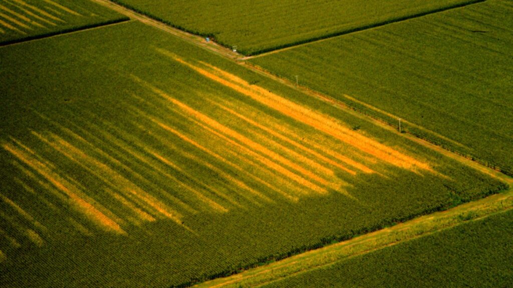
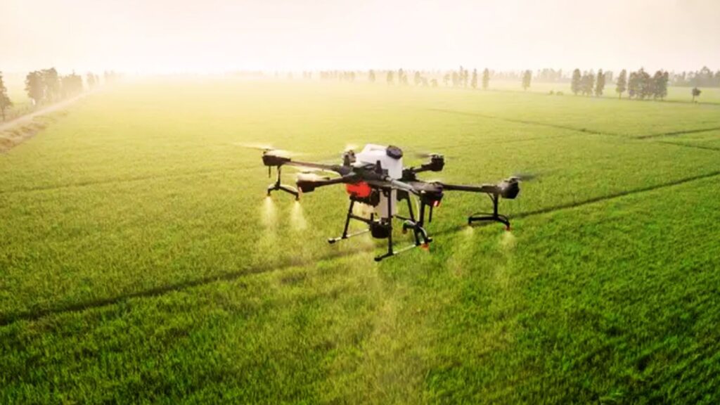
Teledetekcja z bezzałogowego statku latającego (BSL) zyskuje coraz większe znaczenie dla analizy kondycji roślin uprawnych. Głównie ze względu na obrazy o wysokiej rozdzielczości uzyskiwane na małych wysokościach i znacznie mniejsze uzależnienie od warunków pogodowych względem pomiarów satelitarnych.
W wykonywanych okresowo nalotach fotogrametrycznych z zainstalowanymi sensorami RGB, multispektralnymi lub termowizyjnymi uzyskujemy dane pozwalające na wygenerowanie ortofotoplanów sytuacyjnych, numerycznego modelu terenu oraz map wskaźnikowych.
Wskaźniki wegetacji służą do oceny kondycji uprawy, jej stanu rozwoju, prognozowania plonów oraz potencjału biomasy jak również pomagają monitorować stan gleby.
Mapy wskaźnikowe pozwalają na:
analizę żyzności gleby;
wczesną identyfikację szkodników, chwastów oraz chorób roślin;
identyfikację obszarów stresu wodnego;
szacowanie biomasy;
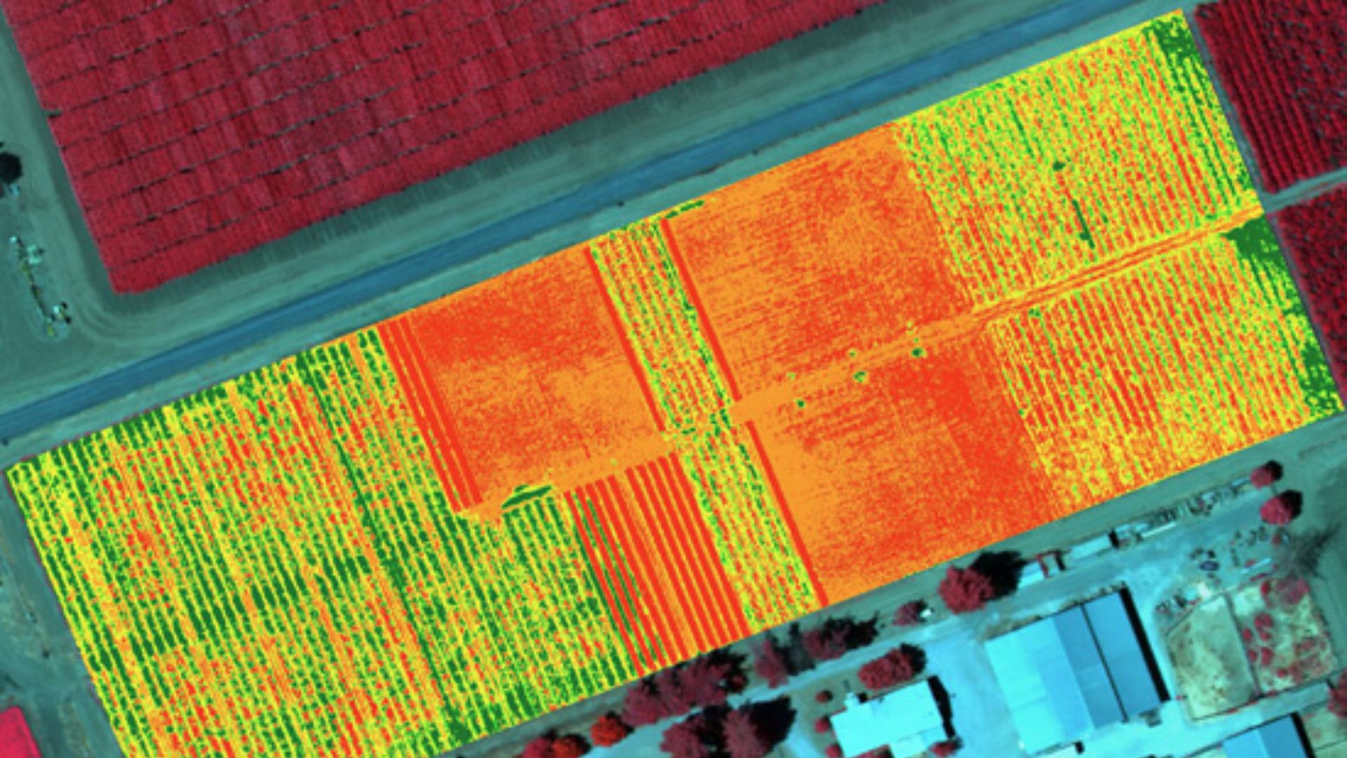
Mapy aplikacyjne
Mapy aplikacyjne stanowią pochodną map wskaźnikowych. W oparciu o rozkład intensywności wybranego wskaźnika wegetacji specjalistyczne oprogramowanie oblicza sugerowany (względny) poziom dawkowania nawozów i środków ochrony roślin.
Dzięki wykorzystaniu algorytmów do analizy wskaźników wegetacji oraz obliczenia dawkowania rolnik jest w stanie:
kontrolować kondycję roślin;
dbać o równomierny wzrost;
intensyfikować plony;
obniżyć koszty interwencji środkami ochrony roślin;
Mapy aplikacyjne stanowią niezbędny dla rolnictwa precyzyjnego instrument. Pozwalają bowiem na wprowadzanie niezbędnych korekt i interwencji w sposób wysoce precyzyjny – co w efekcie przekłada się na wyższe plony, niższe koszty i wyższy dochód. Przekłada się również bezpośrednio na działania sprzyjające ochronie środowiska – poprzez niższy poziom stosowania środków ochrony roślin.
Numeryczne Modele Terenu
Cyfrowe modele powierzchni o wysokiej rozdzielczości (Numeryczne Modele Terenu) umożliwiają analizę ukształtowania terenu pod uprawę oraz i innych cech geofizycznych danego obszaru.
Rzeźba terenu wpływa pośrednio na takie elementy środowiska przyrodniczego jak gleby, warunki wodne i klimatyczne. Bezpośrednio natomiast oddziałuje na organizację produkcji rolnej poprzez wpływ na stopień trudności uprawy roli, czy natężenie erozji gleb. Nachylenia stoków warunkują intensywność procesów erozji, ograniczają zabiegi agrotechniczne i transport, różnicują warunki agroekologiczne, oraz wpływają na występowanie określonych kompleksów glebowo – rolniczych.
Analiza NMT danego obszaru rolniczego pozwala na:
analizę ukształtowania terenu i jego wpływu na stosunki wodne pól uprawnych;
ocenę ryzyka i natężenia erozji gleby;
ocenę stopnia ograniczeń dla zabiegów agrotechnicznych i transportu;
Szacowanie szkód
Szacowanie szkód…
Precyzyjne aplikacje z powietrza (usługa w przygotowaniu)
Precyzyjne aplikacje z powietrza – usługa w przygotowaniu.
Jakość odwzorowania i rekonstrukcji 3D
Wszystkie naloty realizujemy sprzętem z zainstalowanymi modułami RTK, pozwalającymi na obliczenie przez algorytmy specjalistycznego oprogramowania fotogrametrycznego precyzyjnych środków rzutów zdjęć wykonanych w czasie pracy BSL. Dokładność pozycjonowania – w zależności od lokalizacji oraz zakłóceń jono- i troposfery osiąga wartości centymetrowe.
Ponadto – w zależności od rodzaju zlecenia oraz obszaru – korzystamy z założonej przez nasz zespół lokalnej osnowy referencyjnej – tzw. fotopunktów. Każdy fotopunkt zostaje precyzyjnie zmierzony przy pomocy ręcznych odbiorników GPS/RTK i stanowi element siatki referencyjnej dla późniejszej obróbki danych fotogrametrycznych.
Wszystkie chmury punktów, ortofotoplany, NMT oraz modele 3D posiadają zatem jakość odwzorowania, pozwalającą na dokonywanie pomiarów oraz inspekcji cyfrowych bez konieczności uciążliwych wizyt lokalnych.


")